Until the 15th of May, trade in your Phantom 4 and receive up to $2,300 off a brand new Mavic 3 Enterprise RRP $6,999.
Read MoreUntil the 15th of May, trade in your Phantom 4 and receive up to $2,300 off a brand new Mavic 3 Enterprise RRP $6,999.
Read MoreThe next major firmware update for your DJI Enterprise drone is here! DJI have consolidated months of user feedback and testing into an update that packs in loads of new features for the Mavic 3 Enterprise series, Matrice 30 series, and Matrice 300 RTK professional drone platforms. Safe to say, your everyday commercial drone is now more powerful, capable, and helpful than ever.
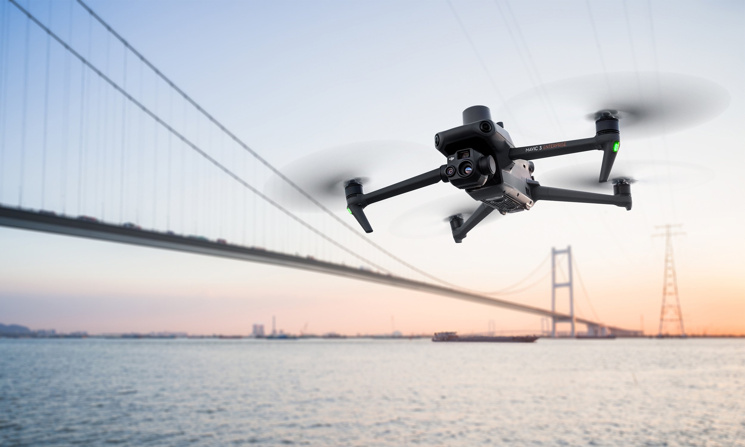
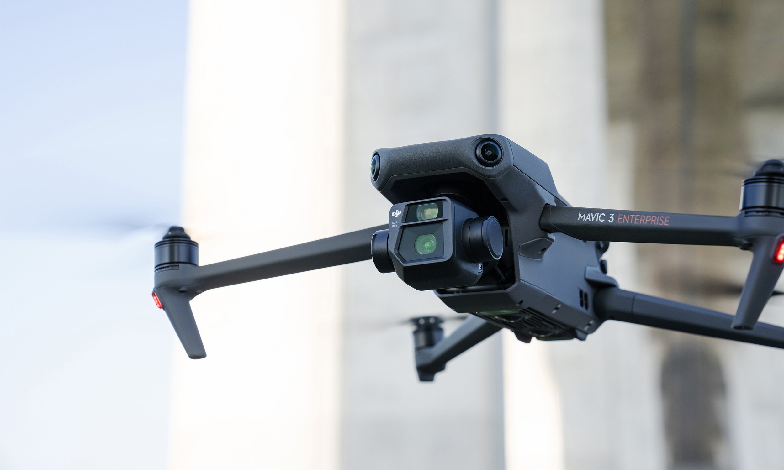
Read MoreThe Mavic 3E (M3E) is a compact, portable, and powerful drone for everyday operations. Whether you’re a hobbyist pilot ready to go pro or searching for a versatile platform to bolster your commercial fleet, the Mavic 3E sets a new industry benchmark.
The M3E’s features make it our most accessible and capable surveying drone to date, while a thermal version, Mavic 3T, is available for emergency, inspection, and night operations. Here are seven things that make the Mavic 3 Enterprise Series the ultimate portable and professional drone platform.
Read MoreWith A 56× Zoom Camera And RTK Module For Centimeter-Level Precision, The Mavic 3 Enterprise Series Brings Mission Efficiency To New Heights.
Read MoreTrying to choose a drone platform for low light or thermal ops? See how the Matrice 30T (M30T), Zenmuse H20N camera, and Mavic 2 Enterprise Advanced (M2EA) results look side by side
Read MoreAs more surveyors see the benefits of integrating drones into their projects, companies are now looking to train their team to take the controls themselves. Upskilling has never been easier with a breadth of new courses specifically designed to turn surveyors into competent and confident drone pilots.
Read MoreWhenever you need to create a detailed model of an area — for surveying, accident reconstruction, or any other purpose — creating a point cloud can be the best way to get the job done.
An accurate, detailed, high-resolution 3D point cloud model is an important element in accurate 3D model creation. If your organization is seeking a new way to create digital reconstructions of physical spaces or structures, drones capable of generating point clouds may be the perfect tool for you.
Read MoreHow accurate is accurate enough? If you’re like most land surveyors, the answer is “as much as possible.”
With an RTK drone, surveyors and other kinds of enterprise drone pilots can expect centimeter-level positioning accuracy with each flight. The system represents a marked improvement from satellite data on its own and can help ensure you have the accurate information you need to get the job done.
Read MoreThermal imaging in drones has been gaining popularity in recent years as this technology has become more accessible with significant price decreases in recent months.
In this article we are showcasing a selection of applications our customers in New Zealand have been using with thermal drones.
Read MoreTake a look at some sample footage from the Matrice 300 RTK and Zenmuse H20.
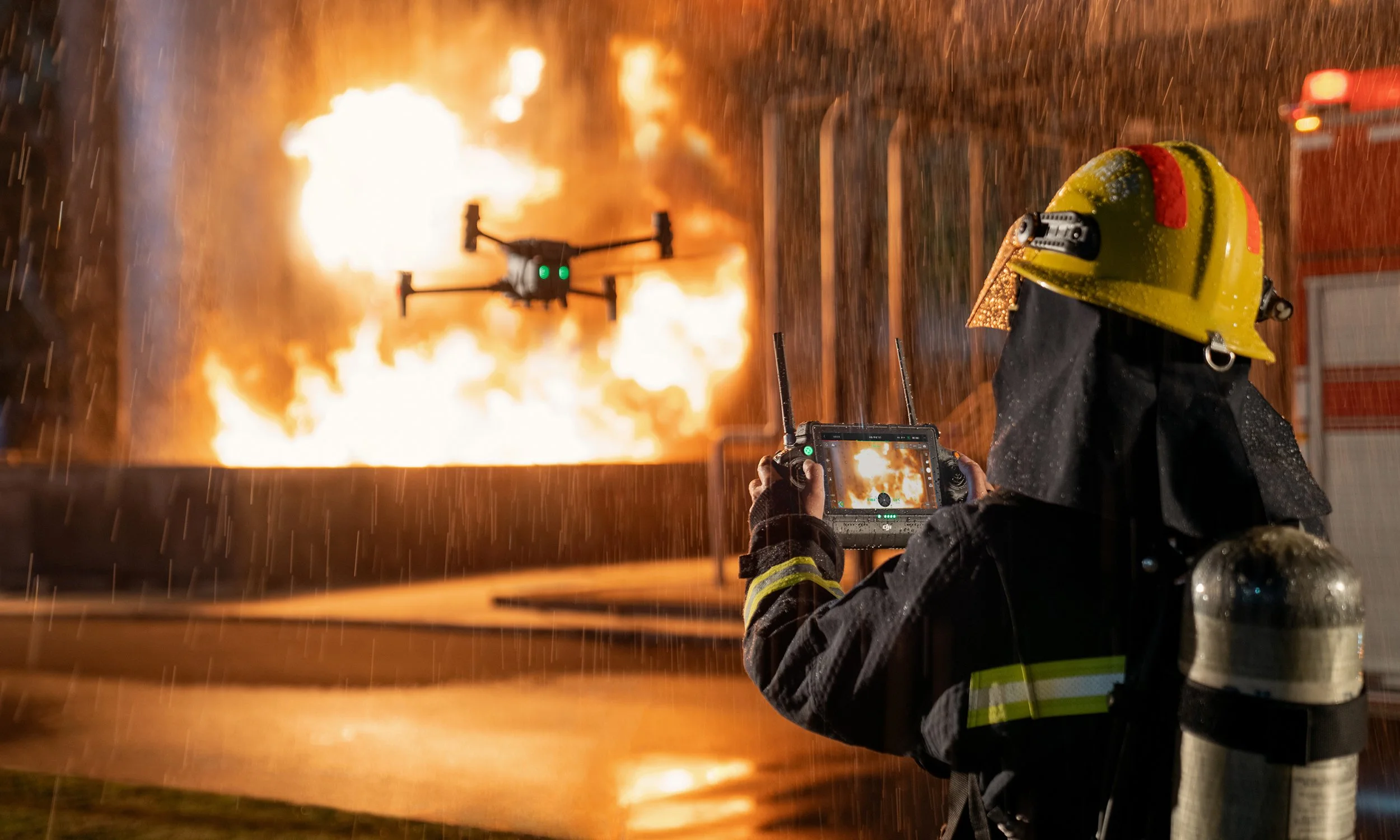
Read MoreRemote aerial sensing technology gives inspection personnel, Search and Rescue and Law Enforcement agencies more thorough, frequent, safer, and efficient inspections. Drones equipped with infrared cameras can be used to detect irregularities in insulation and pooling water, find a missing person in dangerous terrain or assess a fire hazard situation. With a zoom camera drone, the pilots can visually identify problems without having to be physically there. Read more to find out about Thermal Imaging Drones.
Read MoreOver the last 12 months, we have seen a large increase in New Zealand geospatial professionals utilising drones to capture centimetre accurate survey-grade photos and data. With the development of RTK enabled drones the surveying process has become faster, safer and more efficient.
Read MoreWe interviewed Maksym Khovalko, UAV Specialist at Woods to learn more about how they utilise drone technology on their projects. Woods is a New Zealand, and employee-owned multi-disciplinary consultancy with a primary office located in Auckland and a secondary office located in Christchurch. Established in 1970, Woods has now grown to become a substantial consultancy with a team of 120 specialists providing Urban Design, Architecture, Engineering, Planning, Surveying and Geo-Spatial services to the land development, building, health, institutional, energy, government, and transport sectors, to name a few.
Read More